September 22, 2011
The Troop 259 Trek That Almost Wasn't
Special to the Land Park News
By Bill Kirk
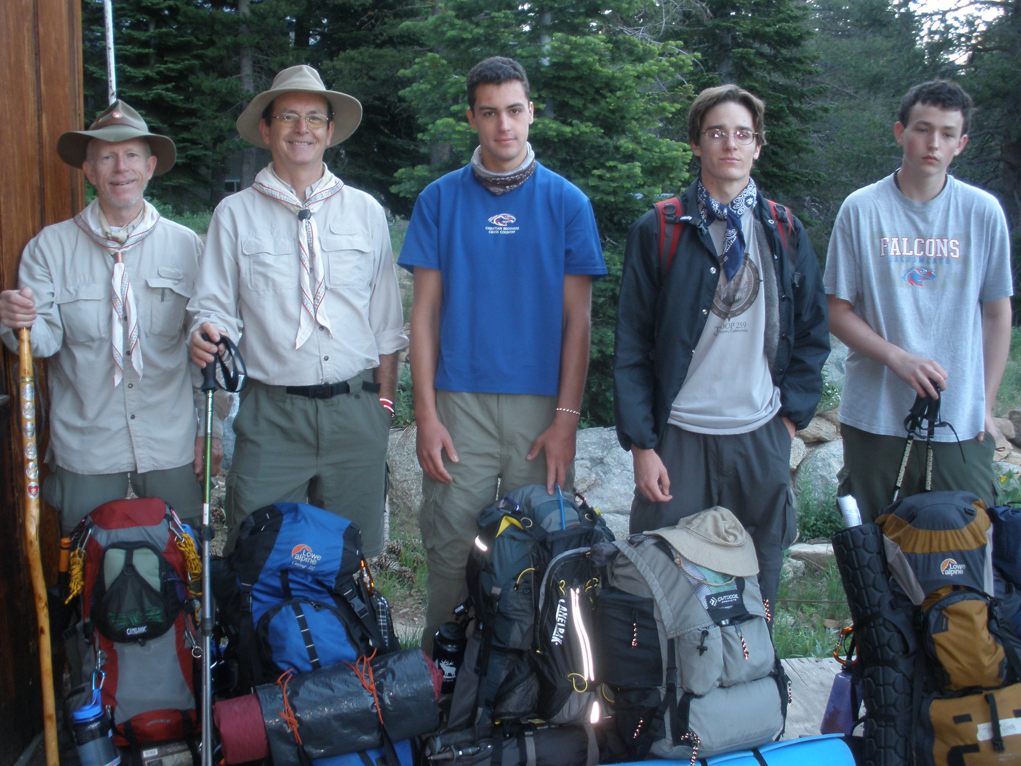 Five trekkers from Troop 259 have a lot to talk about after their recent six-day, 66-mile jaunt through Desolation Wilderness along the Pacific Crest Trail. The trek team included Eagle Scouts Matthew Puliz and Mark Matney, Star Scout Joseph Krieg and Scout Leaders Ike Krieg and Bill Kirk. It's a trip that almost didn't happen.
Planning for the trek began last November. The trek was the brainchild of Eagle Scout Matthew Puliz, a long time Scout in Troop 259. Let's just say he was looking for one last Scouting challenge before leaving for college in the fall. And as it turned out, it was challenging indeed in ways we hadn't anticipated.
In early spring, we got down to the practicalities of physical conditioning, identifying light weight gear and researching high calorie, easy to prepare food. We also began to narrow the field of trekkers, first to those age 14 and above and more importantly to those committed to making the trek. What started out as a potential pool of nearly 15 trekkers, eventually became five.
Although an important planning consideration, thoughts about weather were fleeting. With months remaining before departure, there was no reason to think the prevailing warmer weather patterns wouldn't prevail right on schedule to clear the trail for our trek. However, in June reports began to pile up about how the heavier than usual snows in the Sierra had extended the ski season. We realized that what was a boon to skiers and snow boarders might have a major downside for Pacific Crest Trail (PCT) trekkers all along the 2,627 miles of the PCT from Mexico to Canada.
Counting on warm temperatures in the summer, we were still confident the trail would be clear for our trek the end of July. Then just three weeks from our departure came the reports about serious snow encountered by hikers on the PCT-snow too deep on slopes too steep to safely negotiate without poles, crampons and ice picks. The weather was warming so why wasn't the snow melting?
Calls to the Ranger Stations were no less cautionary. Possible cancellation of the trip loomed as a serious consideration. Finally, in mid-July the warmer weather began to make enough of a difference in the snow pack for a "go" decision just three days before our planned departure.
On Friday, July 29, our group of five drove up highway 50 to Echo Lake where we laid over for the evening at Todd Thompson's place. Joining us was another group of younger Troop 259 backpackers who would follow a different trail to the south of highway 50 for the weekend. In part the delay en route allowed the hikers in both groups to acclimate to the 7,500 feet elevation before kicking it up a notch out on the trail.
Day One:
Our destination for the day was Dick's Lake, nearly 15 miles away. Under normal trail conditions, that distance would be very doable. And based on our start at the Echo Lake PCT trailhead at 7:30 a.m., our chances looked good.
However, after leaving Lower Echo Lake and Upper Echo Lake behind us, by the time we arrived at Aloha Lake at 8,120 feet elevation, the traces of snow became more frequent and more expansive, with snow actually covering the trail. In fact, we lost the trail with no idea where we might pick it up again. After finally reconnecting with the trail, the "up" after Susie Lake was grueling but it was just a taste of the elevation gain approaching Dick's Pass, elevation 9,380 feet.
Day Two:
We got a late start, leaving Gilmore Lake by 9:30 a.m. At that point, the sun had already begun to warm the air and the mosquitoes were on the hunt. But with almost no wildlife on the trail except a rare sighting of an occasional bird or marmot, how could there be so many mosquitoes with so little to feed on-except us, that is? And based on bites where bites shouldn't be, clearly mosquitoes are not picky eaters.
The rest of the day, we hit several large snow fields. We quickly learned if the slope faces north, you can count on snow. Navigating across even narrow stretches of snow is a challenge with a pack on your back. And sometimes contour lines on a map can be deceiving. By the time we stopped at 6:30 p.m. were close to the intersection with the Genevieve Trail and ready to bed down for the night.
Day Three:
We were now comfortable with our morning routine and we were up and out of our camp by 8:30 a.m. Along the three-mile hike en route to Richardson Lake we saw the first signs of true spring in the High Sierra. Lupens, mule ear, sheep's ear, cats paws and a host of other flowers were everywhere. This was definitely a weird year for weather effects.
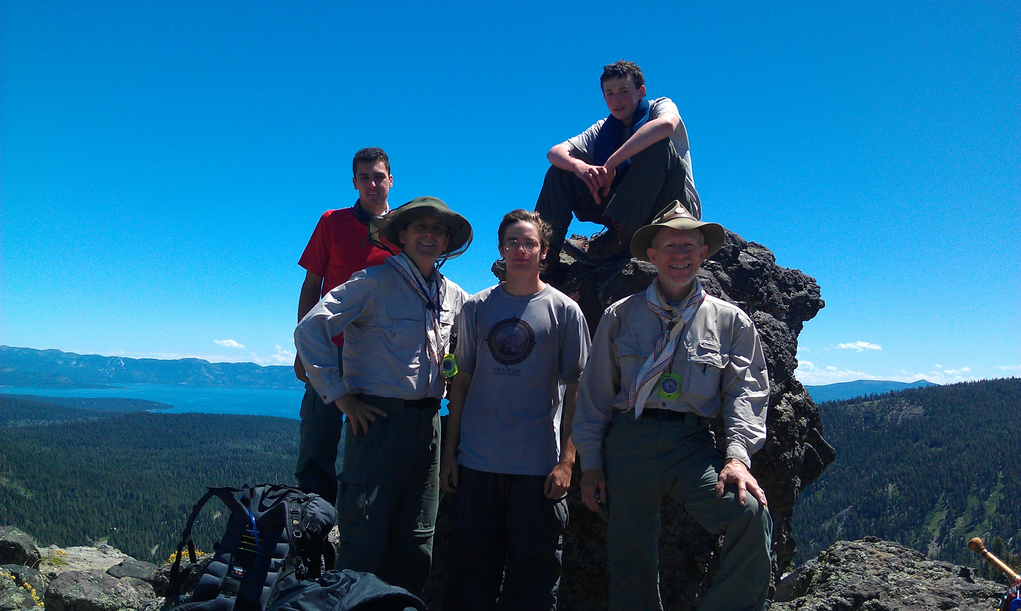 The climb out toward Barker Pass was grueling. Several large patches of snow on the north facing slopes slowed our pace dramatically. And even on the clear, south facing slopes, the uphills were a challenge. During the last mile or so before Barker Pass, wide meadows stretched out on both sides of the trail. Almost immediately beyond Barker Pass, we encountered large snow fields and punctuating the day was one last stream crossing with dubious snow bridges separating us from the campsite. The views of nearby peaks and Lake Tahoe in the distance were spectacular.
Day Four:
With renewed energy after a relaxing end of the day in camp yesterday, we pulled out of camp at 8:20 a.m., heading north - or so we believed. Somehow, in our departure from camp, we jumped on the only clear exit from camp. In retrospect, our entry into camp the day before had followed sharp diagonals across deep snow fields through heavy forest. We had actually cut across the true trail into camp, which was lost in the snow. It was purely our good fortune to have run across two hikers so soon after our departure that morning.
Finally back on course, we were making good time. At 10:30 a.m. we reached Twin Peaks, four miles into the day. The more or less flat section of the trail continued along a long ridge at about 8,000 feet elevation above and to the west of Lake Tahoe. The continuing easy "down" of about 400 feet brought us to our campsite by 6 p.m. Fortunately, there was a fast flowing creek within about 100 meters of our camp. We hadn't counted on having water so close.
In camp we made our first (and only) fire on the trail - just large enough to smoke out the mosquitoes and remind us of what a campfire in the outdoors is like. Overall, the day was a very good day: challenges early, then we made good time the rest of the day.
Day Five:
Despite our exhaustion the previous night, we woke up earlier than expected on day five-the last full day of our trek. We topped off our water bottles before heading into a long, dry section of the trail. In no time, we were right in the middle of a hard "up" from our current elevation of 7,300 feet to over 8,500 feet.
It wasn't long before we found ourselves on a ridge above Squaw Valley. And did I mention there was snow? To someone who isn't a fan of roller coasters, jumping off ledges or slipping and sliding uncontrollably, I can only describe the scene as a vision of death at first glance. For some reason, others in the group saw the 100-foot drop from a snow ledge, down a steep embankment to rocks and trees below as a fun diversion. But all I could think was: I should have called my life insurance agent before we left.
As it turned out, getting off the ridge and down the embankment was more fun than I had anticipated. We couldn't help but congratulate ourselves on our human toboggan skills before striking out across the next snow field toward a marshy meadow below. Our earlier estimate of a short day totally evaporated as we searched for the trail we lost in the snow at the top of the ledge. It wouldn't be the only time we would lose the trail that day and, like the trail, the price in lost time would be steep.
Hours later, we were finally within sight of Anderson Peak. The trail traced the top of the ridge line with a clear down slope on both sides. Although we made good progress due to very little elevation change, time had begun to work against us. By 7:30 p.m. the wind had picked up, steady at 15 to 20 mph and the air temperature (mostly due to wind chill) had dropped.
A certain urgency entered the equation as we started looking for any flat spot to pitch our tents. We would even settle for a spot big enough to spread our sleeping bags under the stars. Then, rounding a turn in the trail, we ran dead on into a huge field of snow at least 10 to 15 feet deep, 100 meters to the path of the trail on the other side. Looking down the expanse of the snow field, the slope dropped steeply over 400 feet below us, amid boulders and loose rock. There was no way to cross this snow field - not that night and probably not the next morning. One slip and there would be no way to stop.
Darkness had overtaken us and this was the first night we used our headlamps. It had been a long day: 12 hours on the trail and we were already wondering what the morning would bring to block our intended reconnection with the trail.
Day Six:
The final day of the trek took us to Donner Pass Road. The sky was brilliant blue at sunrise. The wind had moved on but it was still cold enough (in the low 30s) that all of us added layers. I suppose camping right next to several tons of snow will have a chilling effect. By the time we finished breakfast, our camp was in full sun and the layers started coming off as we broke camp for the last time.
Anticipating two hours to navigate around the snow field and reconnect with the trail, we managed to make our way down the steep, rocky slope, then to zig-zag our way up through heavy sage brush and mule ear in just under an hour. We were so proud of ourselves that we stood in the middle of the trail basking in our success (i.e., no death or injury to the old man) for a good 15 minutes. Once underway, it was a relatively flat hike toward Sugar Bowl. The boys charged ahead, knowing that cold water, fresh fruit, hot showers and pizza were just a few hours away.
Lingering a while at the top of the Sugar Bowl ski run, we admired the views for the last time. Then we struck out on our last 3.5 mile downhill stretch past Mount Judah and on toward Donner Pass Road. Within an hour of hitting the parking lot, we had cleaned up the trail dust and landed in a booth at the Truckee Round Table Pizza Restaurant. I don't think I have ever seen three family-size pizzas disappear so fast.
* * *
Copyright © 1993 by the Suttertown News and 2002-2015 by billkirkwrites. All rights reserved http://www.billkirkwrites.com